October 17, 2023 - Annual Foliage Flight
Day One - Part One
Delaware River, Catskills, South Albany
It's time for my annual foliage flight up to Maine. Last year using the little town of Millinocket, in Central Maine, as my base of operations worked out really well, so I decided to do it again this year. But this year I would spend two nights there, and also cover northern Maine. I would also use a more western route flying up. I had wanted to go up last week, but it was raining up in Maine. It was not raining this week, but it was partly cloudy, and it was past peak in northern Maine, but it was now or never.
At the Skypark, getting ready to go. I put the car in the hangar for overnight trips. Essex Skypark not a secure place after dark.

Here we go! I get an early start and was soon in the air Tuesday morning and transitioning through Martin State Airport's Class D airspace, heading north. As you can see, it's a beautiful day here in Maryland.

North of the Susquehanna River, flying over scenic Amish country in Pennsylvania.


It's always easy to navigate to Pottstown, PA.


The Airport Cafe where a delicious breakfast (or lunch) can be had. Always gotta like a restaurant with airplanes hanging overhead.
This was a good way to start the trip.


I first became aware of the Delaware Water Gap while reading Bill Bryson's excellent book about hiking the Appalachian Trail: A Walk in the Woods.
He said: Just occasionally am I permitted an appreciative glimpse into the wonder that is geology, and such a place is the Delaware Water Gap. There, above the serene Delaware River, stands Kittatinny Mountain, a wall of rock 1,300 feet high ... that was exposed when the river cut a passage through softer rock on its quiet, steady progress to the sea." "In the 1850s, a plush 250-room hotel called Kittatinny House arose on the banks of the river and was such a success that others soon followed. For a generation after the Civil War, the Delaware Water Gap was the place to be in summer. Then, as is always the way with these things, the White Mountains came into fashion, then Niagara Falls, then the Catskills, then the Disneys. Now almost no one comes to the Water Gap to stay. People still pass through in larger numbers, but they park in a turnout, have a brief appreciative gaze, then get back in their cars and drive off."


The Hall at Castle Inn, now a single, private event venue in the restored Castle Hotel -- dead center of this image -- is the only thing left from the glory days.


A closer look at the Shawnee Inn.


Pennsylvania is on the left and New Jersey on the right.


We have Matamoras, PA on the left, and Port Jervis, NY on the right. Although you can't see it, the plane is right over another river bridge which has the Tri-States Monument. This is where three states -- Pennsylvania, New Jersey and New York -- come together.
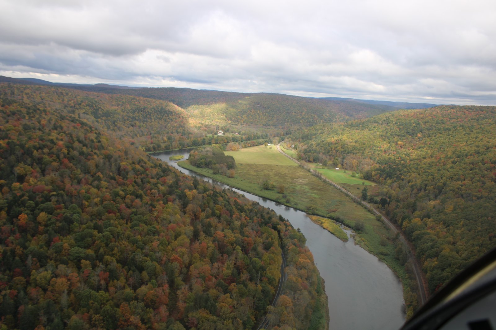
The Delaware River makes a 90-degree turn left to the northwest at this point. I follow it.


A small house sits on a large grassy area in the bend of the river.


Starting to see some color.


Frisbie Island sits in the middle of the Delaware River.

Over the town of Hancock, New York. Just south of Handock, the Delaware River splits into an East Branch and West Branch. I follow the East Branch into the Catskill Mountains. I've heard of the Catskill Mountains, of course, but never been there. People vacation in them in the summer right? Never really even knew where they were until I planned this trip, saw them and decided to fly through them.


I'm still on the East Branch but it had turned northeast. Here I am passing Peaceful Valley campground.


After passing Downsville, straight ahead is Cannonsville Reservoir. The sky has turned to solid overcast.


It's a long one.


Really seeing the color now.

The low overcast was beginning to concern me. I headed towards the brighter areas and passes.

Here, I'm approaching the little town of Margaretville. Not to be confused with Margaritaville. Still on the East Branch Delaware River.


Not going west!


I soon come to the Schoharie Reservoir. The weather is getting better.
About this time I decide to stop at South Albany Airport which has a decent avgas price.


South Albany Airport in sight, at center on the other side of that big railroad yard. Albany, capital of the State of New York is in the distance.


On final for runway One at South Albany (4B0).


All important restroom on the left. Avgas price $6.05. Can you believe that's a low price?!
